DIGA DEL VAJONT / ERTO AND CASSO
The Vajont Dam

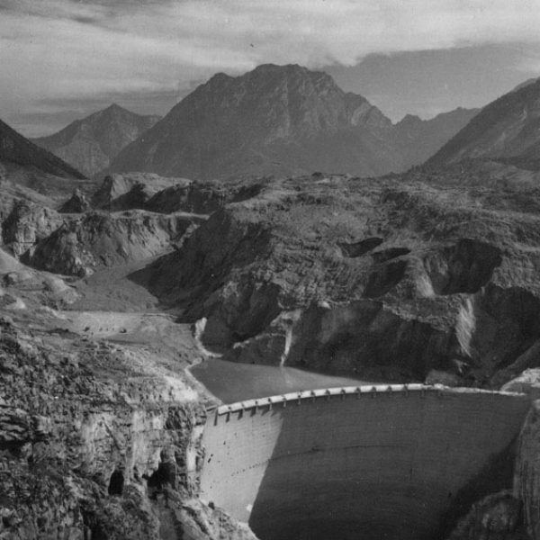
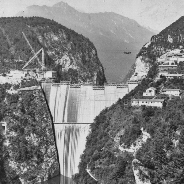
In the valley of Monte Toc we find the Diga del Vajont, or Vajont Dam. This 262-metre-high dam makes it the fifth-highest dam in the world. We find the Vajont Dam in the municipality of Erto, about 50 km from Vittorio Veneto. Erto lies within the territory of the Friulian Dolomites Nature Park. The construction of the dam between 1956 and 1961 created a large reservoir. The intention was to use the water from the reservoir to generate energy. However, things turned out completely differently.

The landslide that caused a disaster
In 1959, several landslides were observed when people wanted to build a road along Monte Toc. After investigation, several experts stated that the entire side of Monte Toc was unstable and might collapse into the basin once filling of the reservoir was completed. However, the planners of power company SADE ignored the findings of the study. Two years after the dam was built, on the night of 9 October 1963, a landslide triggered a huge tidal wave that swept over the edge of the dam. The tidal wave completely swept away the nearest villages, covering them under a thick layer of mud. The disaster killed more than 2,000 people. Since then, the reservoir has not been used. Today, you can visit this area and there are guided tours of the dam.
An original Italian newspaper article
LA FRANA DELLA DIGA DEL VAJON Vajont 9 ottobre 1963 ore 22.45
“Un sasso è caduto in un bicchiere colmo d’acqua e l’acqua traboccata sulla tovaglia”.
Tutto qui.
Solo che il bicchiere era alto centinaia di metri e il sasso era grande come una montagna e di sotto sulla tovaglia, stavano migliaia di creature umane che non potevano difendersi.
(D:BUZZATI, Corriere della Sera venerdì 11 ottobre 1963, p. 3).
Freely translated: “A stone fell into a glass of water and as a result, the water flowed over the tablecloth.”
That’s all.
Except that the glass was hundreds of metres high and the stone as big as a mountain. And down on the tablecloth were thousands of people who could not get to safety.
A huge mass of rock
The landslide that broke loose from the northern slopes of Monte Toc was massive, with a front of more than two kilometres, a width of at least 500 metres and a height of about 250 metres. More than 270 million cubic metres of rock and debris were carried into the valley. Comparable to an area of 2,000 football fields and about 25 times the height of St Mark’s bell tower. When you start clearing this mass with 100 trucks, the level of the debris drops 1 mm per day and it takes over 7 centuries to clear it all.
Besides its enormous size, the landslide also had a very high speed, around 100 km/hour. In just a few seconds, the landslide reached the opposite slope which was more than 100 metres away. The inhabitants of the valley were hopeless and the valley was completely filled with debris and changed forever.
![IMG_20221124_112811 [1280×768] IMG_20221124_112811 [1280x768]](https://discovervittorioveneto.com/wp-content/uploads/elementor/thumbs/IMG_20221124_112811-1280x768-2-q1dkuz1xftwbpjydfycc7gnmz6cx4gm0jwkvgde7w0.jpg)
The tidal waves
At the time of the disaster, the water in the reservoir had a height of 240 metres and the lake was about a third full. The force of the landslide caused two waves: one upstream, which swept the villages along the banks of the lake, and one downstream. The second wave engulfed the dam wall and rose above it until it hit the lowest houses in the village of Casso, 240 metres above the dam. Then this tidal wave flowed into the narrow canyon of the Vajont, with increasing speed and force. At the exit of the canyon, the 70-metre-high water mass flowed into the Piave Valley at a speed of about 96 km/hour. In the course of this, the town of Longarone and several nearby villages were wiped out. The disaster, which occurred in less than five minutes, claimed 2018 victims.

487 VICTIMS WERE CHILDREN UNDER THE AGE OF 15

To commemorate the tragedy, the Vajont Museum was established, which can be visited at the nature park’s visitor centre. There, you will have the opportunity to walk a stretch over the dam and observe the impressive landscape of the landslide of Mount Toc and of the underlying valley of Longarone.
ERTO AND CASSO
Erto and Casso are two villages you should definitely visit while visiting Friuli Venezia Giulia. This not only because of their artistic and natural charm, but especially because of the area’s sad history. They are two separate villages that make up one municipality. They are spread out on either side of the Monte Toc landslide.

I suggest you start with a walk to CASSO, the most beautiful village (at least for me).
A well-marked crossroads leads to Casso, high on the northern slope of the valley.
Thanks to its location, the village was less severely affected by the landslide than Erto. Casso is therefore better preserved. Notable in Casso is the typical house construction. The characteristic stone tower houses (a national monument since 1976) are truly fascinating and worth a walk.
For nature and hiking lovers, the area offers numerous routes in the beautiful surroundings of the Friulian Dolomites.
Erto is also home to a very well-known rock climbing centre of international stature.
A visit to Erto is sure to take you back in time. It seems as if time has stood still here. The silence is almost deafening. It is unimaginable that the village is still intact. If only the walls could talk.
